Page contents
- Consultation point – status of information
- Lens 1 description
- Potential number of homes and amount of employment land that might be delivered through this lens
- Places and sites explored in this lens
- How this lens performs against council priorities and plan objectives
- Rural villages and settlements
- Summary of infrastructure challenges in this lens
- Lens map and site list
Consultation point – status of information
6a.1 In this consultation we are seeking your views on 3 alternative ‘lenses’ which have been explored to make choices as to where new homes, jobs and infrastructure might go. We are showing the places, individual sites, number of homes and amount of employment land which could have been delivered under each lens. Each lens represents a potential alternative approach to building a strategy to meet our needs for new homes and jobs, while balancing this against environmental, social and infrastructure issues.
6a.2 Please also read section 5. Towards an emerging preferred strategy. Although no decisions have been made at this stage, we have presented what we believe to be an appropriate preferred strategy based on what we know to date, influenced by the three lenses and sites within, presented in this consultation. The final strategy is yet to be determined and will be influenced by the further evidence we continue to gather, as well as your consultation comments on our emerging preferred strategy and each of the alternative lenses.
6a.3 This No Green Belt Loss lens is not the final strategy. The sites we are showing and consulting with you on below are those we have explored through this lens. Further consultation and information is required to determine the most appropriate strategy to deliver homes, jobs and change in our new Local Plan. In technical planning speak at this point this strategy lens and potential site allocations carry very limited planning weight in the determination of planning applications and do not form the new adopted strategy for our Local Plan.
6a.4 Please read and review this lens, the sites and amount of new homes at each place suggested and let us know your thoughts. This will assist us in determining if the emerging preferred strategy has the most appropriate places and sites for a preferred strategy to deliver homes, jobs, services and infrastructure required in our new Local Plan.
Lens 1 description
6a.5 Over 40% of South Gloucestershire is covered by Green Belt, major changes to the extent and boundaries of the Green Belt were last made in the Core Strategy in 2013. In our area the Green Belt separates Bristol and Bath, surrounds the communities of the Bristol North and East Fringe urban areas, the Severnside employment area, and stretches as far as Yate, Thornbury and Marshfield. Over the last half century, it has been successful in preventing the main urban area sprawling and joining together surrounding places such as Winterbourne, Coalpit Heath, Yate, Pucklechurch, Wick and Bitton.
6a.6 The focus of this strategy lens was to maintain the current extent of the Green Belt in South Gloucestershire. Under this approach new homes and jobs would have exclusively been allocated on sites that avoid any change or loss of designated Green Belt. Through this lens we explored what this might look like, how many homes and what employment land it could have delivered, where and what the potential site allocations would be. Along with the opportunities and challenges it would present if this strategy lens formed the basis of the Plan’s Preferred Strategy.
6a.7 The Green Belt is a national planning designation, with strict planning rules. Before any decisions are made to potentially release Green Belt land for development, we need to understand what a new strategy for homes and jobs in South Gloucestershire would look like and how it would perform, if we planned to meet our needs on sites and in places beyond the Green Belt.
Green Belt locations
6a.8 Green Belt only covers a set area of South Gloucestershire. You can view the current extent of the Green Belt on our adopted policies map. Tick the ‘Locational Strategy’ box and expand that list (using the + sign) to also also tick the ‘CS5 Green Belt’ box.
The purpose of the Green Belt
6a.9 The Green Belt is designated for very specific purposes and does not apply to all countryside and open areas in South Gloucestershire. The main aim of Green Belt is to prevent urban sprawl and keep land open. National policy sets out a clear role and five purposes for land that is protected as Green Belt. If you want to understand the five purposes, you can view this in the National Planning Policy Framework.
6a.10 It is important to note that land is not given Green Belt status because of its landscape or ecological quality, or because areas of land have open space and recreation function. High-quality landscapes, important habitats and open spaces used for recreation, both in the Green Belt and outside are protected by other national and local policies.
Potential number of homes and amount of employment land that might be delivered through this lens
6a.11 Based on the sites which have passed our initial assessment process, this strategy lens would have delivered:
- up to 8,353 new homes in the plan period and
- 11ha of new employment land
6a.12 However, below we explored why we believe this is not deliverable over the plan period due to the delivery of infrastructure in a timely manner, impacts on the role and function of existing places as well as individual on site constraints and off-site impacts.
Places and sites explored in this lens
6a.13 This lens would have focused new homes and jobs on potential sites beyond the Green Belt. The approach would have required the use of a range of sites around the three market towns of Thornbury, Yate and Chipping Sodbury and maximising the amount of growth possible at Charfield, building on the potential sustainability opportunity given by the new rail station.
6a.14 This lens would have also required a strategy which maximises developer Call for Sites in a range of different sized villages and settlements that exist beyond the Green Belt. For example, the range of Call for Site submissions at Falfield would have seen the village grow significantly under this lens and included land for employment along with some local level services. This strategy lens and avoiding any change to Green Belt would have also included the allocation and delivery of a significant new settlement at Buckover that would have been supported by a range of local level services and range of education facilities.
6a.15 A strategy which looked to deliver the scale of homes and jobs in the northern part of South Gloucestershire, with significant growth at Charfield, Falfield, in a new settlement and surrounding places such as Thornbury, Tytherington, Cromhall and Wickwar would create a requirement for a substantially different type of transport strategy, including public transport for the north of the authority and a significant upgrade to Junction 14 on the M5 Motorway Strategic Road Network.
6a.16 In combination the range of sites and quantum of growth in the locations required under this strategy lens would have created a reliance on longer travel journeys, particularly to employment and key service centres. The delivery of a high quality and frequent public transport service as well as alternative active travel routes would have been challenging to deliver and secure in the long term in the places put forward under this lens.
6a.17 When we explored each of these places in this lens, a range of potentially suitable sites were available to deliver homes and jobs. We would like your views on whether this lens and the sites within are the places that should grow and change to accommodate our needs for new homes and jobs rather than the sites presented in our emerging preferred strategy in section 5.
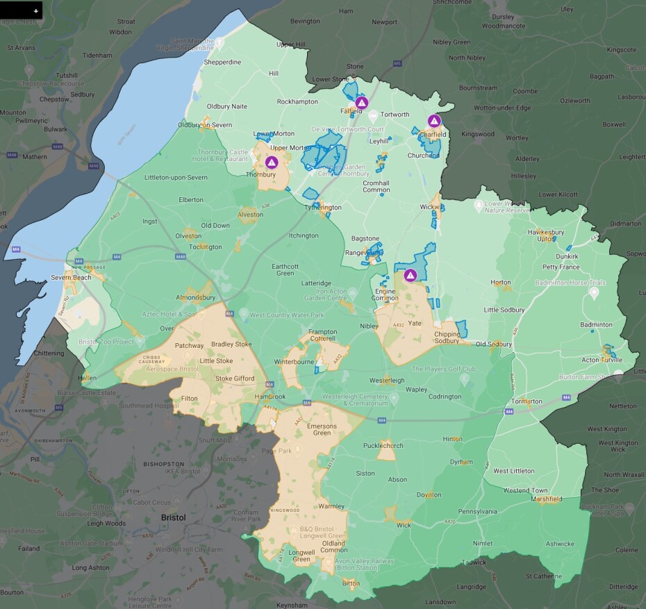
6a.18 You can find out more and comment on this lens and the potential site allocations in each place, using our interactive map.
6a.19 You can also check the potential site allocations at each place in this table.
6a.20 The places included in the ‘no Green Belt loss’ lens can be found below. For each place we have also indicated the total number of potential sites and the potential number of homes and amount of employment land they could deliver in the plan period if they were taken forward into our preferred strategy.
6a.21 The potential to deliver can only be based on the information we have at this stage including information submitted by the promoter and our initial estimates on capacity and delivery set out in our Housing and Economic Land Availability Assessment (HELAA). These capacity estimates are subject to change as we start to gain more detailed information about each site, including their infrastructure needs. Some sites may continue to build out past the plan period and where this is likely an initial estimate of delivery after 2040 is also set out in this table.
How this lens performs against council priorities and plan objectives
6a.22 Overall, if progressed as our preferred strategy this lens would have the key benefit of avoiding the loss of the Green Belt over the plan period. However, in doing so, the lens would present several challenges to align with our key objectives for delivering homes and jobs in a sustainable way. Challenges such as:
- planning for only a proportionate number of homes and jobs in rural villages and settlements such as Falfield, Cromhall, Wickwar, Rangeworthy and Tytherington would be compromised, as maximising growth in these locations would be required and significant changes to the village character and scale would arise
- the geographic balance of homes and jobs across the authority would likely lead to significant increases in commuting from the northern parts of the authority to market towns and urban area to access employment, town centre facilities and leisure
- linked to longer distance commuting and travel a negative impact on the objective of encouraging low carbon travel and public transport provision, or encourage walking and cycling wherever possible due to the distances involved
- the ability to fund and deliver the strategic infrastructure needed particularly at the M5 Motorway Junction 14 and provide significant enhancement to public transport access and networks across the places and sites in the lens
- a disproportionate balance of homes including affordable housing in places in the north and rural areas of South Gloucestershire beyond the Green Belt when these may be required closer to Bristol. Placing the majority of our affordable homes in rural locations with a need to commute may compound cost of living issues.
6a.23 In avoiding the Green Belt many potential places and sites across South Gloucestershire would be ruled out. This has made demonstrating the Plan would fully meet the need for homes and jobs more difficult. Consequently, in attempting to reach the minimum housing need figure maximising sites in a range of villages and settlements creates conflict with key objectives such as protecting the historic environment, decarbonising travel and delivering a proportionate number of homes and jobs in rural villages.
6a.24 By putting homes and jobs beyond the Green Belt it is likely that those living in these new homes would need to travel longer distances to have access to the jobs, services and facilities available in the main market towns, town centres and enterprise areas of urban areas and greater Bristol. Locating all our required homes under this approach is inherently unsustainable as it will promote and encourage longer car-based commuter travel unless reliable, attractive and competitive public transport services could be secured and delivered. Securing a reliable and frequent public transport alternative is particularly challenging for this lens due to the long distances covered in reaching centres such as Bristol and the spread of rural villages.
Buckover, Charfield and Falfield
6a.25 These places are in the north of the district and feature several potential sites that could deliver a large number of homes however as outlined in section 5 the promotions at Buckover and Falfield are not currently featured as part of the emerging preferred strategy. Charfield would be well connected with the confirmed delivery of Charfield Station whereas Buckover and Falfield would still be reliant on the strategic road network which is already busy. The Buckover promotion, is one of the largest proposals put forward through the call for sites process but presents challenges due to it combined impact with sites at Falfield on the M5 motorway junction 14. If our housing target were to be met by adopting this lens, it would mean that Buckover would need to be taken forward as part of our Preferred Strategy. Below are the opportunities and challenges we identified when we explored this part of the lens and explains how we determined which places should feature in our emerging preferred strategy.
6a.26 Opportunities
- The delivery of a new local centre at Buckover with new local services and facilities would support those already in the north of the district and could relieve pressure on services at other main service centres.
- The delivery of primary school and secondary school provision on the Buckover site may relive pressure in this part of the district and provide choice.
- With the delivery of Charfield Station there will be an opportunity to reduce private car travel dependence in the immediate locality.
- The delivery of employment land as part of site L1-CHAR12 in Falfield could support the rural economy and offer some opportunities for shorter commutes.
- The delivery of homes in this part of the district could support delivery of projects such as the Charfield to Wotton Greenway route.
6a.27 Challenges
- This level of growth would result in higher volumes of traffic on the local and strategic network and further information would be required to understand the full impact however we know there would be safety and capacity issues at the M5 motorway junction 14.
- Pressure on the capacity and number of school places across this part of the district particularly at Falfield and Charfield. Although this may be possible at Charfield and further work is needed to understand this, the number of homes proposed at Falfield would likely not be enough to fully cost the delivery of a primary school, placing a financial burden on the public purse.
- This level of growth distributed across this part of the district would create communities with limited local access to employment and could therefore build in a requirement to commute across large parts of the district to access jobs and services. A suitable high quality and viable public transport solution to connect Buckover, Charfield and Falfield, with market towns and the urban areas would be challenging due to the disbursement and number of rural areas any service would need to service.
- Provision of high-quality cycle route connections between these communities and services and facilities would be challenging due to the long distances covered to connect these dispersed locations to main service centres.
- This level of growth in this part of the district will likely put pressure on existing services and facilities at Thornbury, including the GP and education facilities.
Thornbury
6a.28 Thornbury has a smaller role to play in this lens due to the limited number of suitable sites which are either not in the Green Belt or otherwise free of significant constraints including the historical character and landscape setting of Thornbury. A smaller number of homes is appropriate and recognises Thornbury’s role as a key service centre in the district. It also has to take into account the loss of employment land, in comparison to growth of homes and population over the previous plan period and the remaining limited employment opportunities. Below are the opportunities and challenges we identified when we explored this part of the lens and explains how we determined which places should feature in our emerging preferred strategy.
6a.29 Opportunities
- This would deliver homes in relative proximity to a key service centre which could support existing services and facilities and offer some opportunities for sustainable travel to access local services.
6a.30 Challenges
- There are no employment sites or employment land offered in a location which already has an imbalance resulting in a dependence on commuting.
- Thornbury to North Bristol Sustainable Transport corridor improvement scheme will enhance walking and cycling connectivity along the A38 and into the North Fringe and provide limited bus priority at key locations Providing more bus priority measures along the corridor would help improve the competitiveness of public transport services against private car, but there are significant constraints in achieving this
- During the local plan period will also be building out our existing commitments which means Thornbury with completions since the Core Strategy will already be delivering a high number of homes proportionate to its role and function as a key service centre. Further large-scale growth could result in issues when considering cumulative impact.
- There are also concerns regarding the capacity of health services in Thornbury. The Severnvale Primary Care Network, which includes GP surgeries at Thornbury, Almondsbury and Pilning is the highest priority for investment in South Gloucestershire to enhance capacity.
Yate and Chipping Sodbury
6a.31 This part of the lens features a range of sites focused around the market towns of Yate and Chipping Sodbury. Yate and Chipping Sodbury are key service centres providing access to services and facilities to their immediate communities and wider rural communities. While there is access to the town centres and train station which could reduce reliance on the private car it is also recognised that the sites promoted and included in this lens are some distance away and may not be able to take advantage of these assets. The downside of course is that growth here potentially reinforces the need to make longer commuter trips that cross the whole width of the Green Belt from and to the edge of Bristol. Below are the opportunities and challenges we identified when we explored this part of the lens and explains how we determined which places should feature in our emerging preferred strategy.
6a.32 Opportunities
- Delivery of new homes including affordable housing at Yate and Chipping Sodbury as main market town in South Gloucestershire.
- Potential to access Yate Station and Yate and Chipping Sodbury Town Centres to access shopping, commercial retail and employment and services and facilities locally and through train and public transport access wider opportunities in our main urban areas and Greater Bristol.
6a.33 Challenges
- Large growth at North Yate on site L1-CSCE14 could not rely on access through Ladden Garden Village and a suitable highways and public transport solution would be required. The current proposal for the additional 2,000 homes to access Yate through Ladden Garden Village is not an acceptable solution. There is likely to be significant negative impacts on the local highway network and A432 corridor through this strategic allocation North of Yate
- A suitable viable and high-quality public transport solution would be required for L1-CSCE14 as the site is some distance from the train station and town centres.
- The plan will also be building out our existing commitments which means Yate will already be delivering a high number of homes proportionate to its role and function as a key service centre. Further large-scale growth could result in issues when considering cumulative impact.
- To have met the need for new homes across the district in this lens it would be necessary to include potential sites that would likely involve a significant level of harm to the historic environment. L1-CSCE12 on land east of Chipping Sodbury, has been identified as likely to cause harm to several listed heritage assets and a sensitive heritage landscape which cannot be mitigated sufficiently to outweigh the possible harm.
- This level of growth proposed on the range of sites would require additional or significantly enhanced primary school facilities would also require a solution to school places which would be put under pressure.
Rural villages and settlements
6a.34 This lens features a number of villages, which would have to grow to meet the need for homes and jobs. We have set out in our Local Plan Phase 1 and Phase 2 consultation documents that planning for a proportionate number of new homes across our rural communities, can help manage and plan for new affordable homes, the rural economy and help support existing services and facilities, including local rural primary schools, subject to working with schools existing capacity.
6a.35 A wider number of smaller site allocations, often developed by smaller and local housebuilding companies, also reduces the potential over reliance on major national housebuilders with large sites such as urban extensions and new settlements. Very large sites will often require a large amount of infrastructure, services and facilities to be provided on site, they can therefore be more challenging to fund and can take longer to deliver, in some instances possibly only delivering at the very end and beyond the Local Plan 15 year period. Reasonable amounts of new affordable homes could possibly be delivered in local communities often where affordability can be an issue and only minimal levels of development has taken place in recent years.
6a.36 Below are the opportunities and challenges we identified when we explored the delivery of homes in rural communities from the sites promoted and included in this lens and explains how we determined which places should feature in our emerging preferred strategy:
6a.37 Opportunities
- Delivering allocations in our rural areas would allow the delivery of a small portion of affordable housing.
- The allocation of smaller sites in rural communities would diversify the portfolio of sites available over the plan period and this would protect the council’s 5-year land supply and prevent further speculative development.
- The delivery of new homes would support the local rural economy and support the vitality of existing business, services and facilities.
6a.39 Challenges
- In order to protect the Green Belt taking forward all sites in this strategy lens would result in a level of growth that is considered not proportionate in the following villages, Acton Turville, Cromhall, Rangeworthy, Tytherington and Wickwar. In some of these places there has been a large amount of speculative growth already, but there has not been an enhancement to existing services and facilities and public transport services in all but Acton Turville have significantly declined in recent years.
- This level of growth in some rural communities would overwhelm existing services and facilities whilst not being of scale to fund or support new provision for new services and facilities, such as critical mass for a new primary school, local shop or viable public transport service.
- Based on information currently available, existing primary school capacity could not support the levels of growth from the range of sites put forward and included in this lens at Acton Turville, Cromhall, Rangeworthy and Wickwar. Currently no primary school facilities exist at Tytherington.
- This level of growth in rural communities would not support key objectives to encourage sustainable modes of travel as there would have been a built-in reliance on private car travel where public transport solutions do not currently exist.
- Public transport solutions are unlikely to be viable and attractive due to the long distances involved to travel to key services centres.
- Taking forward the levels of growth and all sites contained in this lens, at Acton Turville, Cromhall, Rangeworthy, Falfield, Wickwar fundamentally alter the rural character and in locations such as the Cotswold Landscape and where they are in proximity to heritage assets cumulatively risk harm to key designations.
Summary of infrastructure challenges in this lens
6a.40 This lens has explored on a number of key infrastructure challenges based on what we currently know and a summary of these can be found below. This is not a final or exhaustive list of infrastructure required and further work would be needed to understand the full scale of the impacts and exactly what infrastructure would be required and how this could be funded and delivered in a timely manner if these sites were to feature in the emerging preferred strategy. Where sites have been included in our emerging preferred strategy, set out in section 5, work is ongoing to understand and resolve these challenges. Your feedback and additional evidence will support any final decision.
Buckover, Charfield and Falfield
- If the level of growth at Buckover, Charfield or Falfield was progressed as part of the Preferred Strategy a significant solution for M5 junction 14 will be required to accommodate this number of homes and jobs at these locations, individually or in combination. At present there is no scheme which is funded or designed.
- New primary and secondary education provision would be required at Charfield, Buckover and Falfield to accommodate this level of new homes.
- Enhancement of rail service frequency from Charfield station Including further investigation of Westerleigh Rail Junction infrastructure to safeguard and expand current frequency.
- Delivery of Charfield to Wotton Under Edge Greenway.
- Suitable and attractive, new and significantly enhanced high frequency public transport solution would be needed to Buckover and Falfield and Thornbury. Solution not currently funded or designed.
- New health and playing pitch provision will be required at these locations. These currently have no funding or certain proposals.
- Provision of high-quality, long distance cycling infrastructure across largely rural areas, to connect rural communities to key service centres or transport hubs including Buckover, Thornbury, Yate, Chipping Sodbury, Charfield and onward Bristol urban areas.
Thornbury
- There is currently a large number of homes yet to be delivered as outlined in the commitments (including speculative development) and any new allocations would need to consider both the impact of this and new development on the existing services and facilities and community cohesion.
- Health and education pressures would need to be further explored and solutions found to expand capacity and services at existing or new facilities.
- Existing public transport connections would need to be enhanced and given priority (frequency and journey time) particularly connecting Thornbury to bus hubs at Bristol, Yate and to the new train station at Charfield.
Yate and Chipping Sodbury
- A new deliverable and fundable access solution would be required if additional homes and jobs were delivered north of Yate. This would need to connect site L1-CSCE14 to the local and major road network without reliance on access through Ladden Garden Village, which has been designed with home zone principles rather than as a through route. This solution would need to consider public transport and active travel connections particularly into Yate, given the distance of the proposed site to the town centre, train station and range of facilities in Yate.
- Health and education pressures would need to be further explored and solutions found, particularly in respect of the delivery of large numbers of homes east of Chipping Sodbury.
- There is currently a large number of homes yet to be delivered as outlined in the commitments and any new allocations would need to consider both the impact of this and new development on the existing services and facilities and community cohesion.
Rural villages and settlements
- Health and education pressures would need to be further explored and solutions found. Providing new primary schools would need a significant critical mass and significant funding to provide.
- Primary schools in Acton Turville, Cromhall, Rangeworthy, Wickwar are very small and or at capacity and there is a limit on the number of homes that could be included in a preferred strategy, or investment to expand provision would be required. Tytherington and Falfield do not have a primary school, therefore further new homes in either village would require funding of school transport and add pressure onto local roads and schools in Thornbury, or growth would need to be of a scale to provide a new school (Currently new primary schools as a minimum need to be 2FTE in scale).
- Significant enhancements to public transport routes and timings would be needed and solutions in place for the longer term should the level of growth set out in this lens be taken forward. It is likely that any solutions would be extremely challenging to operate viably as commercial services.
Lens map and site list
6a.41 You can submit your comments on the sites within this option through our interactive map.
6a.42 Alternatively you can view the sites in Appendix 1 and Appendix 2.
Question
Do you have any comments on the No Green Belt Loss strategy lens?
Send us your feedback by completing the questionnaire on our consultation page.
Please submit your comments on individual sites, through our interactive map. You can also provide comments on the overall lens on the map.
Read the next section – Strategy Lens 2: Urban edge.
Or return to the contents page.