Page contents
- What we want to do
- Green Infrastructure and Strategic Green Infrastructure
- What we have done so far
- Updates since Phase 2 consultation
- The Strategic GI Network – option and designations
- Interrelationship between the emerging Local Nature Recovery Strategy and our Nine Strategic Green Infrastructure Corridors
- Linked planning policy
What we want to do
10.1 We want to discuss an updated Strategic Green Infrastructure (GI) Network, which would be safeguarded as part of the new Local Plan. This will be linked to a new strategic policy which will sit alongside a number of saved Local Plan policies which will continue to protect existing designated sites.
10.2 This approach will protect the integrity of the network but also facilitate appropriate change and development within it, so that homes, jobs, infrastructure, biodiversity, recreation, and adaptation to climate change can be planned for and sympathetically co-exist well into the future. The proposed Strategic Green Infrastructure Network does not stop or protect all land within it from development. Although there will be protected sites, areas of landscape and designated assets within the network, in other areas new development and change will be possible. As long as the integrity and function of the network remains and strategic connections between nearby green and blue assets are maintained and enhanced.
Green Infrastructure and Strategic Green Infrastructure
10.3 Green Infrastructure (GI) is defined in the National Planning Policy Framework (NPPF) as:
“A network of multi-functional green and blue spaces and other natural features, urban and rural, which is capable of delivering a wide range of environmental, economic, health and wellbeing benefits for nature, climate, local and wider communities and prosperity.”
10.4 Strategic Green Infrastructure when planned effectively can create a network of larger (landscape) scale sustainable natural and semi natural landscapes and habitat areas, incorporating landscape and heritage features, walking and cycle routes, areas for recreation and leisure, green spaces, rivers, and other water bodies. In South Gloucestershire a number of Green Infrastructure corridors are planned to combine into a network which will connect villages, towns and urban areas and link adjoining countryside and townscape areas.
10.5 At a more local level, community spaces, parks, village greens, orchards, churchyards, nature sites and local footpaths and cycle routes (which are protected by separate local plan policies) all complement and link within the overarching strategic GI. When development and land changes respect the GI network and are coordinated to enhance it with connectivity and functions in mind, there can be wide ranging benefits for people and nature. These include adaptation to climate change, resilience to flood risk by suitable natural flood storage, improved visual amenity and enhanced quality of places and development.
10.6 Designation of a Strategic Green Infrastructure Network will assist in prioritising certain areas for future investment in biodiversity, secured through the emerging national and local requirements for ‘biodiversity net gain’. This investment in biodiversity and nature, when directed to locations in the newly designated Strategic Green Infrastructure Corridors will assist in enhancing and improving the connectivity of the network and establish places where nature and the natural environment can thrive.
10.7 The Strategic Green Infrastructure Network can also act as a focus for implementing ‘natural capital solutions’, rewilding, and taking proactive steps to increase the quality and connectivity of our natural habitats. within the network. The potential of a designated connected network to include areas identified for net gain, increasing tree planting, and enhanced green corridors will also increase carbon sequestration and opportunities for carbon offsetting through enhancements to habitat, green corridors, and new natural areas.
10.8 Therefore, when investigating locations for new growth within South Gloucestershire it is important to plan for both development of homes, jobs, and infrastructure, as well as enhancement to green infrastructure, in a connected and co-ordinated way.
10.9 Parts of our proposed strategic GI network are already protected from development through separate designations in the Local Plan, including, for example: SSSI, SNCI, Ancient Woodland, Conservation Areas, Registered Historic Parks and Gardens, Local Green Spaces, Public Rights of Way. Other parts of the network are protected by legislation such as Common Land.
10.10 However, other parts of the strategic GI network perform an important function in terms of providing a mix of existing and potential connectivity between these areas, as well as offering opportunities for enhancement of the strategic network of woodlands, grasslands, and wetlands. New development proposals for homes, jobs, infrastructure and other uses may be acceptable in the Strategic Green Infrastructure Network; providing they respect the integrity of the network and maintain the function and connectivity of the section of the network they are in.
10.11 It is important to note that outside of the proposed strategic GI network, protection of nationally and locally designated sites and important green and blue GI assets such as the wider area of the Cotswold National Landscape (formally known as AONB – Area of Outstanding Natural Beauty) will still exist. The strategic network identifies areas where connectivity and function are needed on a wider scale and will add to existing protections. Other important assets such as Sites of Nature Conservation Interest, Commons, wetlands, cycle routes, areas of Green Belt and local green projects will still exist and be protected outside the GI Network. The strategic network identifies areas where connectivity and function are needed on a wider scale. A complex web of green assets existing within and outside the Green Infrastructure Network which collectively contribute to our recreation, biodiversity, active travel cultural and heritage offer and quality.
What we have done so far
10.12 In our Phase 2 consultation we identified land that could form part of this Strategic GI Network in terms of its main corridors.
10.13 The Strategic Network of GI corridors, which form part of our emerging Local Nature Recovery Network, has been informed by the West of England Local Nature Partnership (WENP) ecological (habitats) network mapping, which in turn responds to the recommendations contained in the ‘Making Space for Nature’.
10.14 The strategic GI network has also been informed by the ‘West of England Joint Green Infrastructure Strategy’ (JGIS) June 2020.
10.15 In this consultation, alongside the Strategic GI Network, we want to set out where our Key Strategic Viewpoints and Visually Important Hillsides are located in South Gloucestershire. Our emerging Strategic GI and Environment policy consulted on at Phase 2, introduced criteria that along with the GI network, development proposals would need to consider and respond to these viewpoints and hillsides. The landform of many Visually Important Hillsides is closely associated with the diversity of ecological habitats in South Gloucestershire, as well as facilitating key views across the district or forming features in such views.
Updates since Phase 2 consultation
10.16 Listed below is a summary of the key feedback issues we received at the Phase 2 consultation on the Strategic Green Infrastructure Network, which we have responded to:
- Further refinement of the corridor boundaries to:
- ensure that built settlement edges including private gardens were excluded around main settlements (e.g., at Harris Barton – a new mapping base has helped this). Some smaller settlements are washed over by the corridors
- to omit unnecessary white land; however, some white land is included where this is needed for GI connectivity or ecological buffers and linkages
- Extension of Corridor E to include the visually important hillside features within the southern part of the Cotswold National Landscape.
- Adoption of a criteria-based assessment to ensure the proposed visually important hillsides and strategic viewpoints merited identification as such.
- Reduction in the final number of identified Strategic Viewpoints, with some downgraded to ‘local’ views due to their context/composition not meeting the adopted criteria (e.g., YTL development will obscure the view from the airfield toposcope).
10.17 The above refinement and changes to our Strategic Green Infrastructure Network are described, and visually presented, in greater detail within the technical evidence base in the Strategic Green Infrastructure Corridor Mapping Project 2023 in the Green Infrastructure section.
10.18 In addition, since Phase 2 further analysis work has been undertaken to describe and justify the identified visually important hillsides and strategic Viewpoints as part of the separate, but linked, Landscape Character Assessment SPD Refresh (Ref Annex 1 and Annex 2 of this document respectively). These documents and the Corridor Mapping Project 2023 are available on our website.
10.19 Protection of the visually important hillsides and strategic viewpoints forms part of the emerging Strategic Green Infrastructure Policy. We set out our intention to do this in our Phase 2 version of the policy, which is being refined and updated to be presented at Regulation 19. We are now seeking your views on the proposed visually important hillsides and strategic viewpoints which we propose to protect. You can submit your comments through our interactive map.
The Strategic GI Network – option and designations
10.20 In this consultation we want to share the updated Strategic Green Infrastructure Network, this sets out where in district we think the network should be and the nine strategic corridors that form the main, linked network.
10.21 The intention is that the strategic network will be defined on the policies map. Development within, or near to it will be managed by new planning policies, strategies and plans for enhancing the GI corridors and assets within them. Protection of designated and important GI assets lying outside the corridors will remain unchanged.
10.22 We also have identified the Visually Important Hillsides that form part of the Strategic GI Network, together with a set of Strategic Viewpoints, which we intend to designate on the future policies map.
10.23 Please view and comment on the updated Strategic Green Infrastructure Network nine corridors, proposed strategic viewpoints and visually important hillsides on our interactive map below.

Figure 10.1 Strategic Green and Blue-Green Infrastructure Corridors.
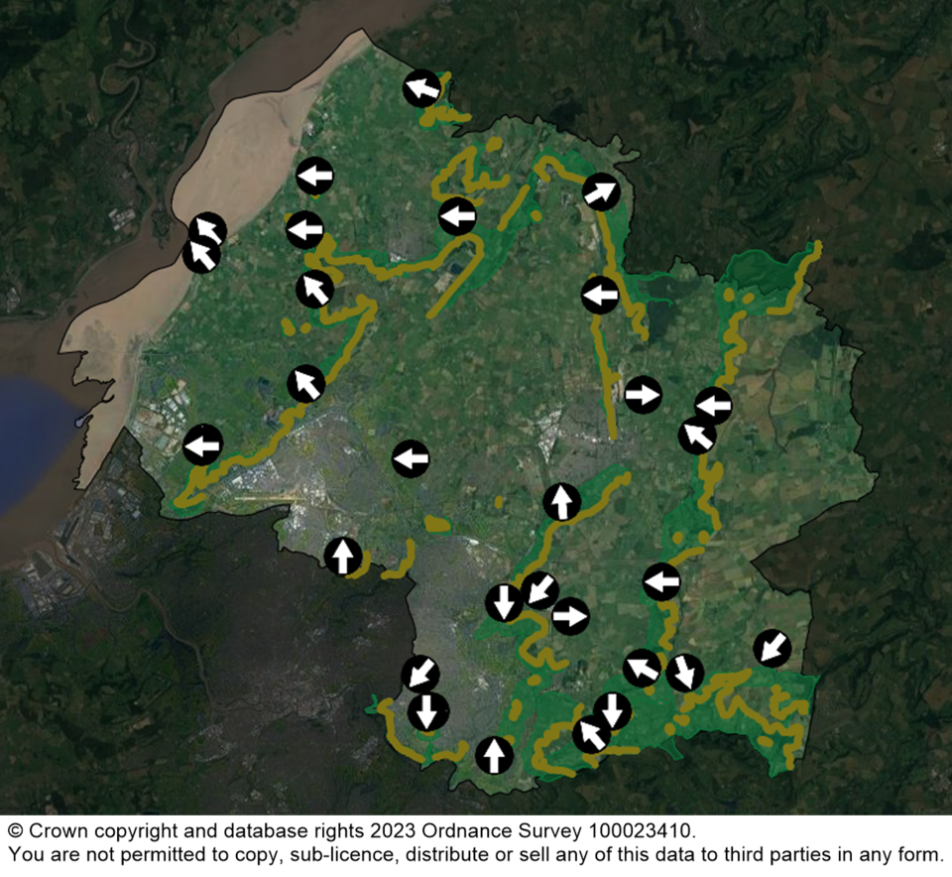
Figure 10.2 Strategic viewpoints and visually important hillsides.
Nine Strategic Green Infrastructure corridors – descriptions
10.25 Each of the nine Green Infrastructure corridors that make up the network have unique functions and individual assets within them. Green assets for example relate to visually important hillside features and associated areas of strategic woodland and grassland habitat. Blue-green assets relate to the Severn estuary and key river corridors and associated strategic wetland habitat network.
10.26 The corridor and nature of assets within it will guide the approach to achieving positive connectivity and enhancement to their quality and function.
10.27 A summary of the nine individual corridors is set out below. Further detailed guidance and information on each corridor is set out in the Strategic Green Infrastructure Corridor Mapping Project.
A. Shepperdine – Oldbury on Severn – Severn Beach (Severn Estuary and Levels)
10.28 Corridor A is a blue-green infrastructure (BGI) corridor, extending from south-west to north-east to follow the River Severn Estuary to take in the marine, foreshore and adjacent Levels areas. Corridor A includes two cut outs which straddle the M4 at Ingst and Junction 1 with the A403 at Severn View. These have been excluded as they occupy higher lying land which rises up out of the main floodplain and therefore do not form part of the primary GI function of Corridor A.
10.29 The primary function and importance of the corridor is focused on the strategic wetland network associated with the Severn Estuary corridor, including a designated Special Protection Area (SPA) / Special Area of Conservation (SAC) / Ramsar and Site of Special Scientific Interest (SSSI) sites, alongside a linked network of rhines and watercourses across the Levels. Some parts of the strategic woodland network extend into the south-east of Corridor A.
10.30 The committed development area of Severnside (South Gloucestershire Policy CS35) lies within Corridor A, and is safeguarded for distribution and other extensive employment uses. Although a lot of the Severnside area is actively being built out, under the original 1957/58 ICI planning consent, unbuilt areas which retain the GI function of Corridor A will be delivered as part of the wider GI masterplan for the area.
B. Charfield – Alveston – Hallen (Western Scarp/ Severn Ridges)
10.31 Corridor B is a green infrastructure (GI) corridor extending from south-west to north-east, before turning south-east along the ‘S shaped’ Severn Ridge, which comprises a series of interlinked scarps that straddle the M5 motorway corridor.
10.32 There are a number of strategic viewpoints towards and from this series of visually important hillside features; 5 Conservation Areas (CA)s lie within the corridor together with a Grade II* registered historic parkland, and five small areas of registered common.
10.33 Its primary function and importance relate to its strategic woodland network associated with a visually important hillside / ridge landform feature with some relatively large sections of ancient woodland. The existing woodland network does not currently extend along the most easterly section. The central part of the corridor, in particular, is crossed by several South Gloucestershire active travel routes, the Jubilee Way long distance footpath and national cycle route 41. Large green spaces include natural and semi-natural green space, and playing fields and sports facilities located in settlements.
C. Winterbourne – Kendleshire – Yate (River Frome Corridor)
10.34 Corridor C is a blue-green infrastructure (BGI) corridor extending from south to north and then northeast and eastwards along the River Frome corridor, with a north westerly fork along the Bradley Brook corridor. There is one strategic viewpoint from the top of Beacon Lane in Winterbourne, with views west across the River Frome valley towards Bradley Stoke and Patchway. Four CAs lie within the corridor together with four small areas of registered common land.
10.35 The primary function and importance of this corridor relates to its strategic wetland network and areas of adjoining grassland habitats associated with both river corridors, with that of the River Frome penetrating the urban areas of Yate and Winterbourne. The corridor also takes in part of the strategic woodland network at its western end and the strategic grassland network at its eastern end. To the east of Chipping Sodbury, the corridor forms a strategically important link between different habitat types, including the grassland network of Corridor D, the woodland network of Corridor E, and the wetland network of Corridor C.
10.36 The committed mixed-use development, and new neighbourhood, area of ‘East of Harry Stoke’ (South Gloucestershire Policy CS27) overlaps with the western margin of Corridor C. GI provision is included within the overarching masterplan for the eastern edge of this development area.
D. Wickwar – Westerleigh – Bitton (Westerleigh Vale/ Oldland Ridge/ East Fringe)
10.37 Corridor D is a green infrastructure (GI) corridor that extends from south to north along the Oldland Ridge and Westerleigh Vale to link with the Pucklechurch Ridge, and further north takes in the Wickwar Ridge. It is separated at its centre near Chipping Sodbury by BGI Corridor C (River Frome).
10.38 There are three strategic viewpoints from this series of ridgelines. Siston CA lies within the corridor and includes the Grade I listed Siston Court. There are a number of registered commons within the corridor, many of which are included within the South Gloucestershire ‘Common Connections’ landscape and habitat restoration project.
10.39 Its primary function and importance relate to a mosaic of strategic woodland and grassland habitat associated with the visually important hillside / ridge landform features within its southern part. It takes in the strategic grassland network principally associated with common land (which are concentrated in its central part), and the strategic woodland network within its northern part, including the Lower Woods SSSI and Wetmoor. Strong links with the strategic wetland network, as part of Corridor C to the east of Chipping Sodbury, are essential for the successful connectivity of Corridor D.
E. Hawkesbury – Upton Cheney – Ashwicke (Cotswold Scarp and Ashwicke Ridges)
10.40 Corridor E is a green infrastructure (GI) corridor extending from south to north to take in the prominent, westerly facing scarp of the Cotswold National Landscape (formally known as AONB), which for the purposes of this project takes in the whole of South Gloucestershire Landscape Character Area (LCA) 4: Cotswolds Scarp, together with connected areas of the strategic GI network. The corridor also takes in the series of valleys and ridges within the southern margin of the CNL, including St Catherine’s valley.
10.41 There are 8 strategic viewpoints with views either towards or from this Visually Important Hillside feature, including long views south and west to Bristol and Wales beyond. 8 CAs lie within the corridor (Hawkesbury Upton, Horton, Dyrham, Doynton, Beach, Upton Cheyney, Cold Ashton, and Marshfield), and 3 registered parks and gardens at Dyrham Park, Dodington House (Grade II* listed) and Ashwicke Hall (Grade II listed). There are also several areas of registered common land.
10.42 The primary function and importance of this corridor relate to its mosaic of strategic woodland and grassland habitat associated with the Visually Important Hillside feature of the Cotswold Scarp. The corridor also takes in a number of historic parks and gardens associated with large estates. Small sections of the strategic wetland network also extend into the corridor, associated with the St Catherine’s Brook and the River Frome, for example.
F. Hanham Green – Hannah Abbots – Bitton (Avon Valley)
10.43 Corridor F is a green infrastructure (GI) corridor running along the south-west facing valley side of the River Avon, south of Hanham. There are 2 strategic viewpoints within the corridor, offering panoramic views from Hanham Hills and the Bristol and Bath Railway (cycle) Path. Hanham Abbots and Bitton (southern half) CAs lie within the corridor, together with a small area of common land at Stephens Green in the centre of the corridor.
10.44 Its primary function and importance are largely associated with the strategic woodland network which traverses the visually important hillside / landform feature, formed by the prominent northern valley side. The corridor also hosts sections of the strategic grassland network at Hanham Hills, and the strategic wetland network associated with the River Avon.
10.45 There are several South Gloucestershire active travel routes, mainly concentrated in the west of the corridor, as well as a section of the Bristol and Bath Railway Path (also part of the Avon Cycleway and NCN route 4) and several long-distance footpaths which cross through the corridor including the River Avon Trail, Monarchs Way, Community Forest Path and The Dramway.
G. Wickwar – Iron Acton (Ladden Valley)
10.46 Corridor G is a blue-green infrastructure (BGI) corridor that extends from south to northeast along the Ladden Brook valley. Additional land away from the river corridor has been included in this narrow blue-green corridor to provide for habitat creation and off-setting.
10.47 The primary function and importance relate to its strategic wetland network associated with the Ladden Brook. Small sections of the strategic woodland network and part of the Wickwar Ridge Visually Important Hillside are also present within this corridor.
10.48 The corridor is crossed by 2 South Gloucestershire active travel routes, as well as the Jubilee Way long distance footpath.
H. Hinton – Doynton – Bitton (Boyd Valley)
10.49 Corridor H is a blue-green infrastructure (BGI) corridor, which takes in the watercourses of the River Boyd and the Feltham Brook in its north before following the course of the River Boyd south through Wick and towards the river Avon.
10.50 The primary function and importance of this corridor relate to its mosaic of strategic wetland, grassland and woodland habitats associated with the length of the River Boyd corridor, as well as the strategic wetland network associated with its tributary, the Feltham Brook.
I. Huntingford – Charfield – Wickwar (Little Avon River Corridor)
10.51 Corridor I is a blue-green infrastructure (BGI) corridor extending from south to north-west along the Little Avon valley near Charfield. Additional land away from the river corridor has been included in this narrow blue-green corridor to provide for habitat creation and off-setting. Although seemingly local in scale, Corridor I is considered to be of strategic importance due to its rich mosaic of terrestrial and riparian habitat, as well as its potential to form strategic connections with surrounding local authorities.
10.52 Its primary function and importance are its strategic wetland network associated with the river, which also takes in part of the strategic woodland network at both its southern and northern ends, as well as the strategic grassland network at its southern end.
10.53 One South Gloucestershire active travel route passes through the corridor to the east of Charfield, as well as a short section of the Avon Cycleway (a regional cycle route) north of Wickwar. Corridor I also provide a good opportunity for making green and blue linkages with surrounding Local Planning Authorities, including better connecting Charfield with Wotton-under-Edge and Kingswood via the Greenway, promoted active travel route.
Interrelationship between the emerging Local Nature Recovery Strategy and our Nine Strategic Green Infrastructure Corridors
10.54 The West of England Combined Authority has been designated as the ‘Responsible Authority’ for delivery of the Local Nature Recovery Strategy (LNRS) in the West of England. This means WECA will be responsible for ensuring the LNRS is produced in line with the forthcoming guidance and regulation from DEFRA. Under powers given to the council its role as Local Planning Authority (LPS) it is a supporting authority’ in the preparation of the LNRS. The LNRS will identify desired outcomes for nature recovery in the region, including those considered to be ‘priorities’, and potential measures to deliver them. The LNRS will:
- agree priorities for nature’s recovery
- map the most valuable existing areas for nature, and
- map specific proposals for creating or improving habitat for nature and wider environmental goals
- direct biodiversity net gain funding into areas that will deliver the greatest benefits to nature and will inform the planning process and public authorities
- inform the delivery of ‘nature-based solutions’ for outcomes such as flood management, carbon sequestration and improvements in water quality
- used to help the public, private and voluntary sectors work more effectively together for nature’s recovery, and enable collective effort to be focussed where it will have most benefit. on the ground and increase the effectiveness of funding
10.55 Whilst the proposed Strategic GI Corridors will complement the emerging LNRS work, GI embraces a more diverse functionality, encompassing not only the local ecological network (as set out in the LNRS), but also all the other GI elements, such as facilitating active travel routes, landscape features etc, climate change mitigation and adaption, flood management, noise attenuation which combine to provide multifunctional GI. The Strategic GI Corridors define a concentration of overall GI assets which the council will seek to deliver strategic GI initiatives, which also incorporate priorities for nature recovery. They will also make sure the LNRS takes account of the council’s priorities and plans. This is important because under the Levelling Up and Regeneration Act all local planning authorities will have a duty to take account of their relevant LNRS.
Linked planning policy
10.56 We consulted on an initial draft of the Strategic Green Infrastructure and Environment Policy in our Phase 2 consultation. We are refining the policy based on feedback and updated evidence and will present the updated version in the draft Local Plan at Regulation 19 stage.
10.57 As part of this Phase 3 consultation we have shared technical information further justifying the visually important hillsides, and strategic viewpoints, that forms part of the draft policy considerations; along with further refinement, evidence, and justification for the Strategic Green Infrastructure Network.
10.58 Within the strategic GI network some land will continue to be protected from development through separate designations and policies in the Local Plan e.g. SSSI (currently policy PSP18), SNCI (currently policy PSP19), Ancient Woodland (current policy PSP3), Local Green Spaces (currently policy PSP4), public rights of way or protected by other legislation such as Common Land.
10.59 In the remainder of the network there will be a need to maintain its functional connectivity, through the placement and design of new homes, jobs and infrastructure, and through those developments providing new GI assets such as wildlife corridors, open spaces, tree and woodland planting grassland and wetland habitat, and new playing pitches and recreational facilities.
10.60 In addition to planning policies and designations new strategies and enhancement projects are being developed to improve land, connections and quality of the network throughout South Gloucestershire.
Questions
Do you support the designation of the proposed:
1. Green Infrastructure corridors, or Network
2. Strategic Viewpoints
3. Visually Important Hillsides?
Please submit your comments through our interactive map.
Read the next section – Policy framework and draft policies
Or return to the contents page.